

| Bing and the Bothy |
|
Viking can overlay tracks and waypoints over Bing too... not just OpenStreetMap.
Below is a screen-dump of Viking showing my Boxing Day walk out to The Bothy. It's interesting because it's able to show detail such as me scrambling across the rock faces. This is not particularly useful on Gower but may be useful on bigger mountains. Could be useful for analysis of route finding skills using a compass. E.g. strap a gps on the back of the student and get them to navigate using a compass. Review and analyse the gpx file together with Bing.
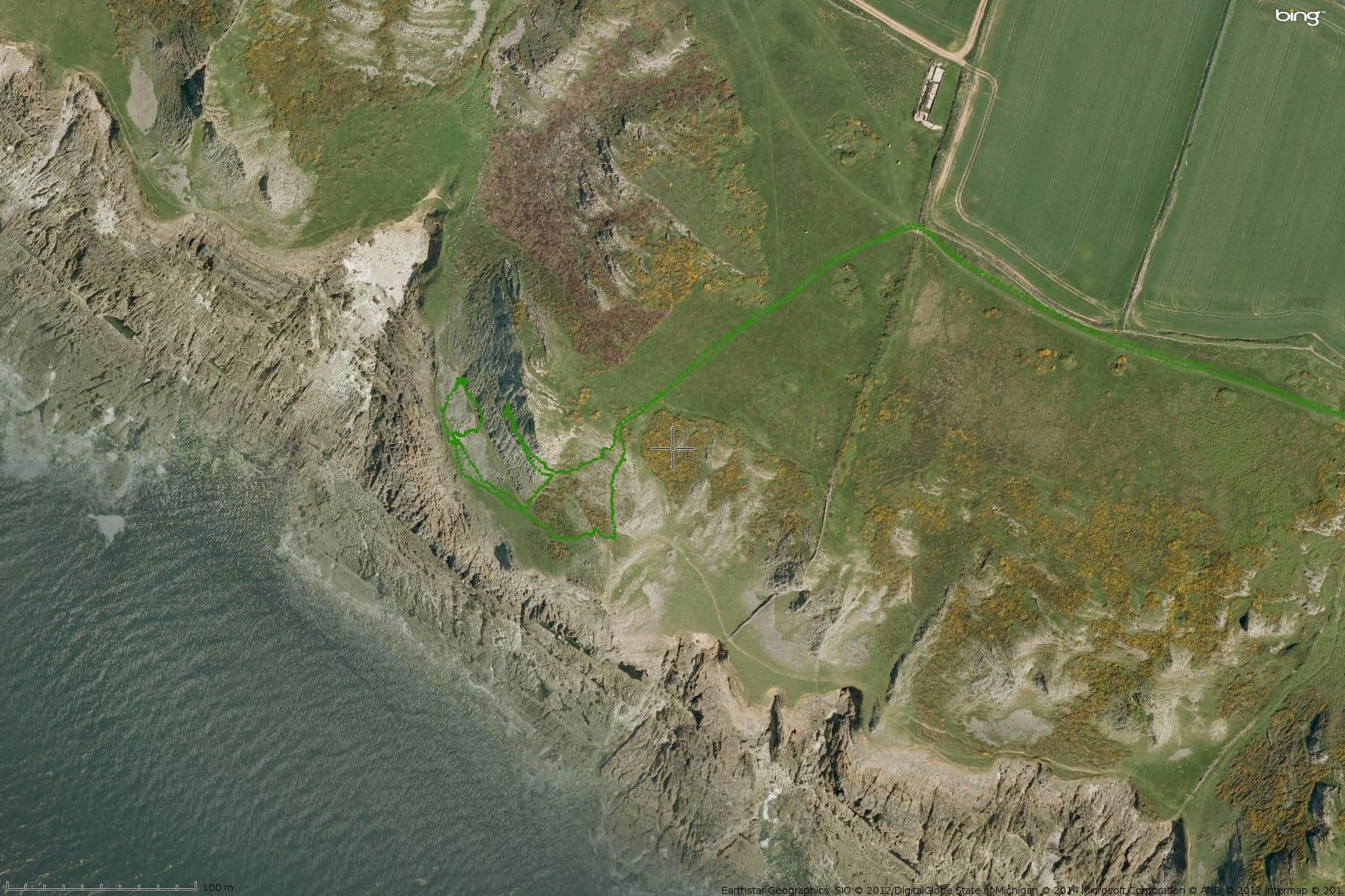
Click a couple of times to get the full-size graphic.
| Sun | Mon | Tue | Wed | Thu | Fri | Sat |
| 1 | 2 | 3 | 4 | |||
| 5 | 6 | 7 | 8 | 9 | 10 | 11 |
| 12 | 13 | 14 | 15 | 16 | 17 | 18 |
| 19 | 20 | 21 | 22 | 23 | 24 | 25 |
| 26 | 27 | 28 | 29 | 30 | 31 | |
| Dec Feb | ||||||
