It's nice to keep a log of walks (or surveys)
using viking.
Here's a screenshot of a recent walk from Overton to Rhossili and
back.
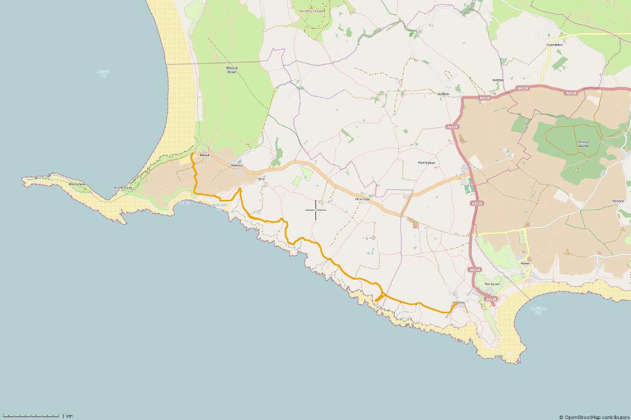
Click on the map to get a full size copy.
Viking does all sorts of other things like real-time logging, import/export
from/to gps, managing/editing of gpx files, export to osm, etc.
Here's another thing it does... it gives graphical output of height
over time.
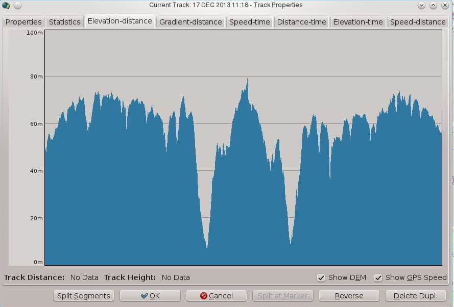 Not much use on Gower but of more use in the mountains.
This graph shows my speed over time. Time isn't shown on the
x-axis... you'd have to click on the graph to get the time.
Not much use on Gower but of more use in the mountains.
This graph shows my speed over time. Time isn't shown on the
x-axis... you'd have to click on the graph to get the time.
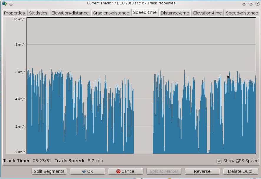 Notice how the speed varies. These variations can be accounted for
stops to take photos, climbing over stiles, etc. The big pause in the
middle is me in the Worm's Head Hotel at Rhossili!
Notice how the speed varies. These variations can be accounted for
stops to take photos, climbing over stiles, etc. The big pause in the
middle is me in the Worm's Head Hotel at Rhossili!